Precision Gnss+Mems Inertial Navigation System for Agricultural Drones ~ Low Power, Anti-Vibration

Customization: Available
After-sales Service: 2 Year
Warranty: 2 Year

Product Description

Basic Information
Model NO.
I3500
Type
Bearing
Application
Tunnel Boring Machine
Certification
CE, ISO9001: 2000
Condition
New
Package Size
50.00cm * 40.00cm * 40.00cm
Gross Weight
30.000kg
Specification
33*27*8mm
Capacity
1000/Month
Origin
China
Product Introduction

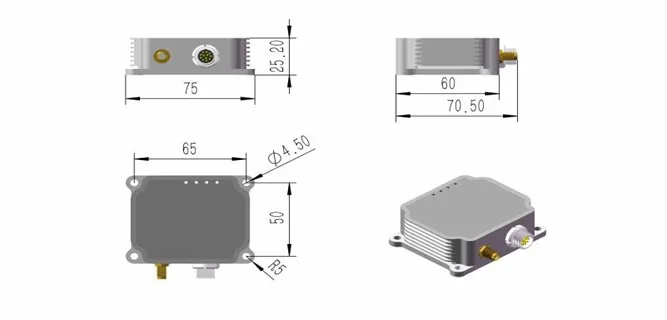
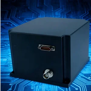
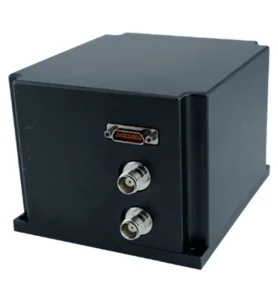
MEMS Integrated Navigation System: I3500

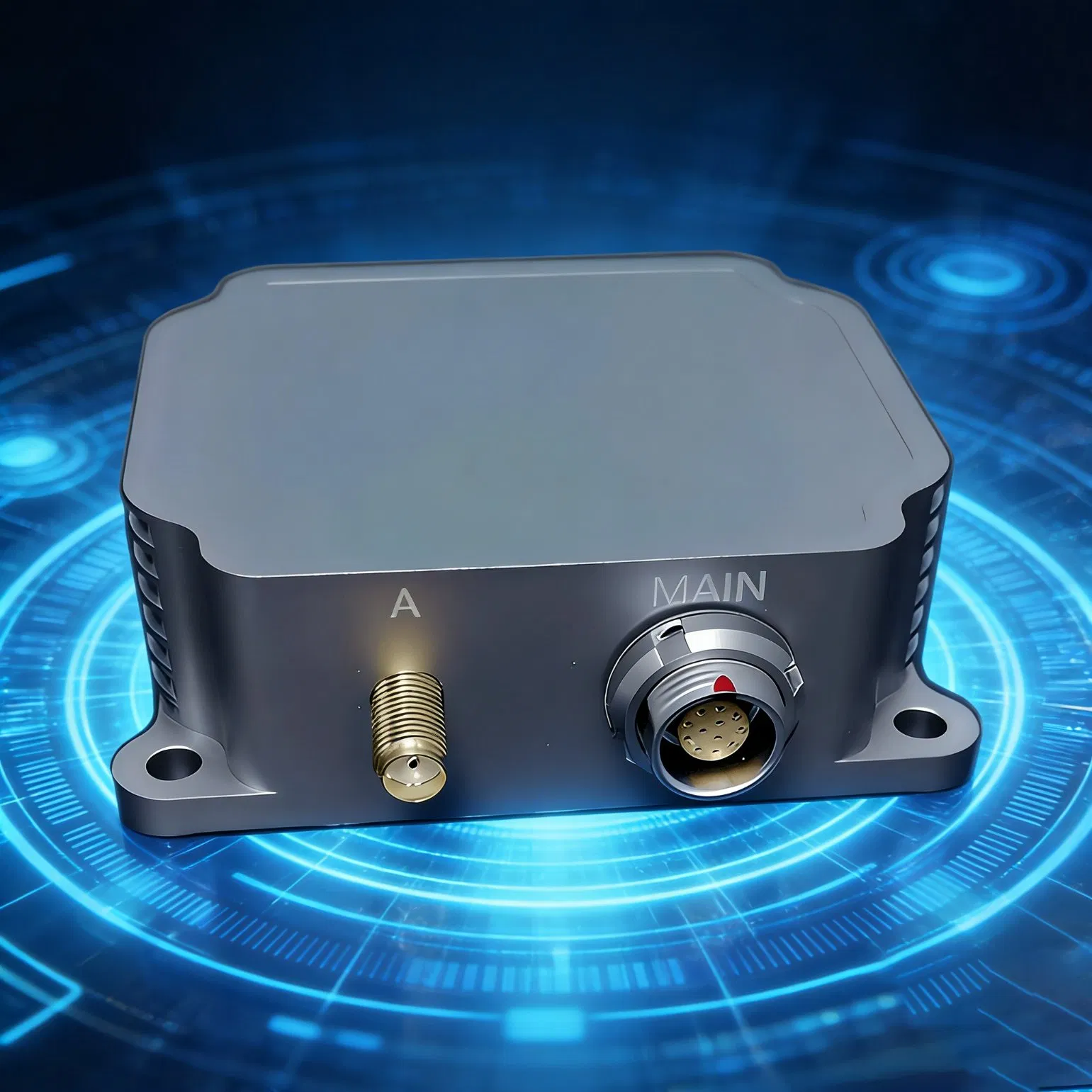
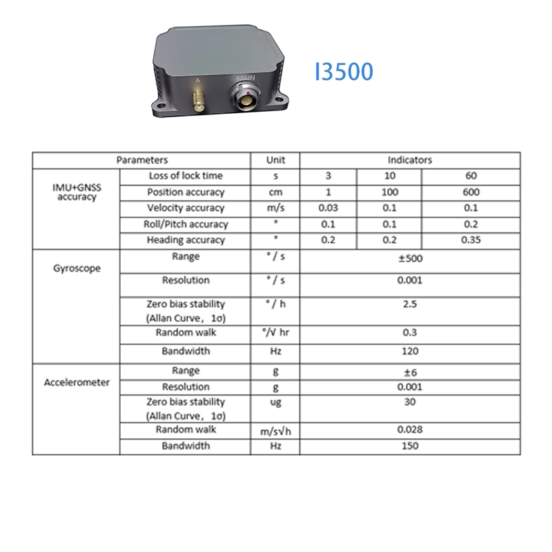
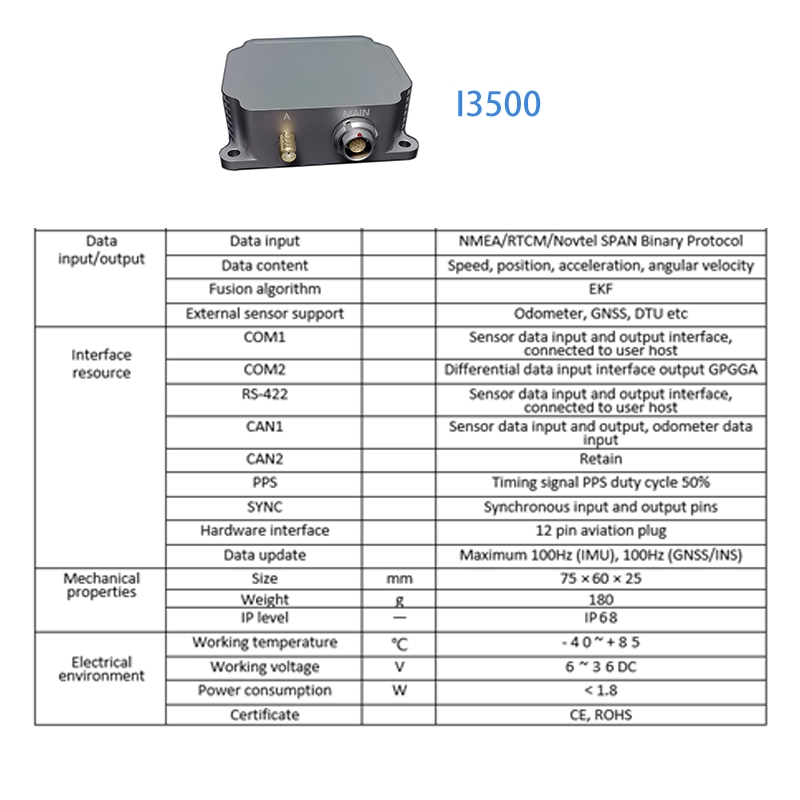
The I3500 is an advanced integrated navigation system (GNSS/INS) featuring high-performance MEMS sensors, a high-precision GNSS system, and high-performance microprocessors. It utilizes a self-developed, high-reliability fusion algorithm to provide real-time speed, position, and attitude data. The IP68 waterproof casing ensures durability for seamless integration into various industrial systems.

Inertial Navigation System
Performance & Features

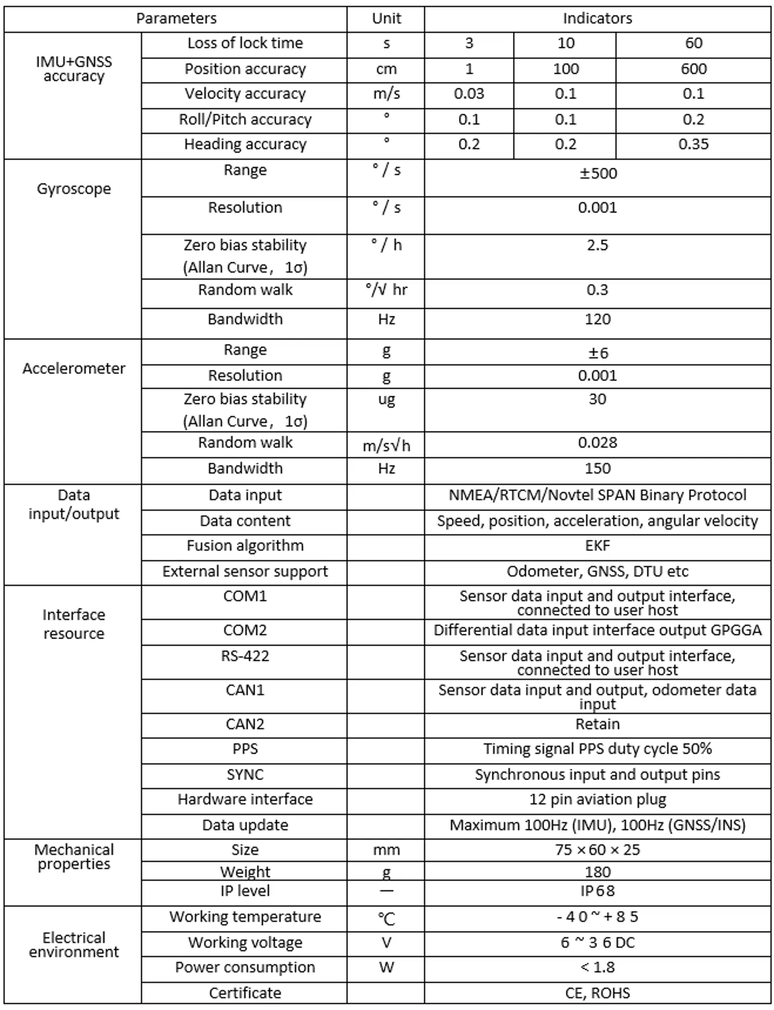
Our inertial sensors are recognized for high precision, long operational life, and extreme reliability. Key advantages include:

  • High-performance MEMS gyroscope and accelerometer.
  • Support for external RTCM differential data for high-precision RTK positioning.
  • Robust anti-vibration and low power consumption design.
  • Real-time output of attitude, heading, velocity, and position.
Precision MEMS
Application Areas

The I3500 accurately senses movement data, complementing Lidar and Camera solutions to enhance navigation reliability in:

  • Unmanned Aerial Vehicles (UAV / Drones)
  • Robot Navigation & Unmanned Vessels (ROV)
  • Smart Agricultural Machinery
  • Driverless Vehicles & Autonomous Systems
Application 1
Application 2
Application 3
Dimensions & Definitions
Dimensions Guide
Technical Overview Video
Frequently Asked Questions
What is the I3500 Inertial Navigation System?
The I3500 is a high-performance integrated navigation system that combines MEMS gyroscopes, accelerometers, and high-precision GNSS with an advanced EKF fusion algorithm for real-time data.
What is the positioning accuracy of the I3500?
In RTK mode, it achieves 1 cm horizontal and 1.5 cm vertical accuracy. It maintains reliable navigation using inertial sensors even when GNSS signals are temporarily unavailable.
What kind of environment is the I3500 suitable for?
It features an IP68 waterproof shell, making it suitable for harsh industrial environments, agriculture, and marine applications.
Can I connect external differential data?
Yes, the system allows users to externally connect RTCM differential correction data to achieve high-precision RTK positioning.
What data types can the system output?
The system provides real-time output for position, velocity, attitude (roll/pitch), and heading information.
Is it compatible with other navigation sensors?
Absolutely. It is designed to complement Lidar and Camera-based vision systems to enhance overall navigation accuracy and reliability.

Related Products